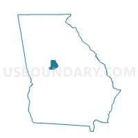
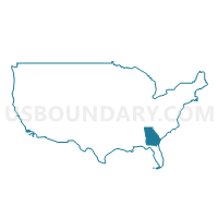
20710 - HIGH FALLS Voting District, Monroe County, Georgia
About
** Data sources from census 2010 **
Maps
Graphs
Neighbors
Neighoring Voting District (by Name) Neighboring Voting District on the Map
- 035BCCC - BUTTS CO COMM C Voting District, Butts County, GA
- 035TOW - TOWALIGA Voting District, Butts County, GA
- 1711712A - CHAPPELL MILL Voting District, Lamar County, GA
- 1711712B - SENIOR CITIZEN Voting District, Lamar County, GA
- 20708 - EVERS Voting District, Monroe County, GA
- 20713 - PROCTORS Voting District, Monroe County, GA
Top 10 Neighboring County Subdivision (by Population) Neighboring County Subdivision on the Map
- Forsyth CCD, Monroe County, GA (16,130)
- Barnesville CCD, Lamar County, GA (11,916)
- Milner CCD, Lamar County, GA (6,401)
- Southwest Butts CCD, Butts County, GA (5,171)
Top 10 Neighboring Unified School District (by Population) Neighboring Unified School District on the Map
- Monroe County School District, GA (26,424)
- Butts County School District, GA (23,655)
- Lamar County School District, GA (18,317)
Top 10 Neighboring State Legislative District Lower Chamber (by Population) Neighboring State Legislative District Lower Chamber on the Map
- State House District 110, GA (80,088)
- State House District 125, GA (54,944)
- State House District 126, GA (48,971)
Top 10 Neighboring State Legislative District Upper Chamber (by Population) Neighboring State Legislative District Upper Chamber on the Map
- State Senate District 18, GA (181,223)
- State Senate District 16, GA (165,379)
- State Senate District 25, GA (160,177)
Top 10 Neighboring 111th Congressional District (by Population) Neighboring 111th Congressional District on the Map
Top 10 Neighboring Census Tract (by Population) Neighboring Census Tract on the Map
- Census Tract 9702, Lamar County, GA (7,722)
- Census Tract 1503, Butts County, GA (7,470)
- Census Tract 9701, Lamar County, GA (6,401)
- Census Tract 501.01, Monroe County, GA (6,167)
- Census Tract 502, Monroe County, GA (5,729)


